Capture Photos with GPS Data Easily
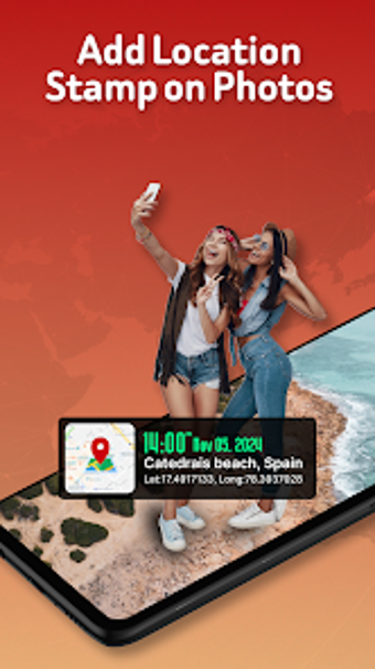
GPS Map Location on Camera is an Android application designed for photography enthusiasts who want to add geographical context to their images. This free multimedia app allows users to capture photos with real-time GPS location, timestamp, and compass data, making it ideal for travelers, professionals, and anyone keen on preserving memories with precise details. The app automatically tags photos with GPS coordinates, altitude, and addresses, ensuring that every snapshot tells a complete story of its surroundings.
In addition to location stamping, the app features a compass overlay for orientation and a real-time map display that shows users their location while taking pictures. Users can personalize images by adding notes and selecting from a variety of stylish templates for displaying the captured data. With its professional-grade capabilities, GPS Map Location on Camera is well-suited for documentation, travel logs, and adventure photography, enhancing the way moments are recorded and shared.